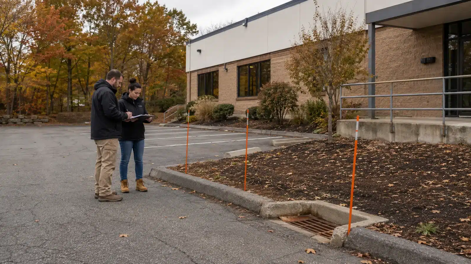



Snow Removal Pre-Season Site Walkthrough: A Hidden-Hazard Checklist
A snow removal pre-season site walkthrough should leave a commercial property manager and snow contractor with the same map of conditions that will disappear under snow. The goal is narrow: record curbs, islands, drains, wheel stops, utilities, surface changes, and movable obstacles before they are hidden. This baseline complements—but does not replace—the route, storage, trigger, and responsibility decisions in the operating plan.
Define the walkthrough deliverable before going outside
Start with a current site plan or a simple aerial print. Add a date, property contact, snow-service contact, north arrow, photo numbers, and a short marker legend. Walk in dry daylight when pavement edges and drainage features are visible. If construction, restriping, tenant work, or utility repairs are underway, label that condition as temporary rather than drawing it as permanent.
The finished record should answer three questions: what is fixed, what changes with the season, and who must report a temporary change before the next storm.
Use one repeatable sequence: walk, classify, mark, photograph, hand off, and verify. A feature is not complete in the record until its field reference, map entry, photo, and update owner agree.
| Site feature | Record before snow | Marker or handoff decision | First-storm check |
|---|---|---|---|
| Curbs, islands, and wheel stops | Ends, corners, height changes, damaged sections, and places that blend into the pavement | Choose a visible reference point without placing a stake in vehicle or pedestrian travel | Confirm markers remain visible and the feature was not struck or buried |
| Drains and low points | Grates, outlets, surrounding grade, debris, and the apparent meltwater route | Show the location on the map; do not place a marker where it blocks flow | Check for blocked inlets, ponding, and overnight refreeze patterns |
| Utilities and emergency features | Hydrants, shutoffs, meters, cabinets, vents, bollards, and overhead conflicts | Use the site owner’s approved visibility method and preserve required access | Verify access and visibility after plowing and relocation of snow |
| Steps, ramps, and surface transitions | Edges, rails, curb ramps, raised units, patched pavement, and changes in material | Photograph from the approach direction and keep the marker outside the route | Walk the cleared connection and note narrowing, buried edges, or new ponding |
| Loading, waste, and service zones | Doors, gates, dock edges, compactors, grease containers, delivery paths, and turning conflicts | Name the person who controls movable items and service timing | Compare the actual operating window with the baseline |
| Temporary conditions | Containers, lifts, fencing, stored materials, excavations, and closed parking | Add an owner and removal or review date; do not treat the condition as permanent | Update the shared map before the next event if the condition changed |
Walk the outside boundary before the center
Begin at the property line and trace the places where pavement meets curbing, planting beds, walls, fences, neighboring drives, and public sidewalks. Then move inward along islands, rows of wheel stops, building edges, and pedestrian connections. This order reduces the chance that a low curb, short wall end, or isolated utility box is missed because it sits outside the normal driving line.
Photograph each feature from the direction snow equipment is likely to approach, then take a second image that shows its relationship to the building or a fixed landmark. A tight close-up documents damage; a wide view helps someone find the same location after snow covers the pavement.
Separate fixed, seasonal, and temporary conditions
Use three labels instead of one undifferentiated list:
- Fixed: curbs, islands, drains, hydrants, utility cabinets, light bases, steps, walls, permanent signs, and loading docks.
- Seasonal: planters, outdoor furniture, temporary vestibules, bike racks, cart corrals, and landscape protection that returns on a predictable schedule.
- Temporary: construction fencing, containers, lifts, excavations, pavement repairs, utility work, and tenant materials that may move without the contractor present.
Every seasonal or temporary item needs an owner and an update trigger. “Property manager reports any change by noon before the forecast event” is useful; “watch for obstacles” is not. Keep the rule in the site record so a staff change does not erase it.
Build a marker legend that survives handoff
A stake without a legend can be ambiguous. Record the marker color or symbol, the feature it represents, the fixed reference used to place it, the installation date, and who will replace it if it moves. Number unusual or high-consequence features so the map, photo, and field marker point to the same entry.
Do not install a marker where it creates a new trip point, narrows a walkway, interferes with a door or curb ramp, hides a sign, blocks drainage, or sits in the equipment path. Marker type and placement should reflect the site’s traffic, surface, visibility, utility, and property-management requirements rather than a generic spacing rule.
Protect the complete accessible connection
For a business, the walkthrough must trace the connection among accessible parking, the access aisle, curb ramp, walkway, and accessible entrance. The U.S. Department of Justice’s ADA small-business primer explains that snow must be removed from accessible parking spaces and access aisles and that the accessible route may not be blocked. Keep markers, equipment, and planned snow placement outside that connection.
Record who checks the route after service and how a blocked or narrowed connection is escalated. The baseline should show the whole path, not just the painted parking symbol.
Turn observations into a photo register
Create one row per feature with its map number, description, wide-photo filename, close-up filename, condition, marker decision, and responsible contact. Add a “changed since walkthrough” field so temporary work does not disappear into email threads.
- Use the same naming sequence on the map, marker legend, and photos.
- Record existing chips, scrapes, cracks, displaced curbs, and stained areas without assigning a cause.
- Include a fixed landmark in each wide photo.
- Keep emergency contacts and utility instructions with the site record, not on a public-facing map.
- Archive the signed baseline where both the property team and contractor can retrieve it during a storm.
The record supports communication; it does not certify pavement, drainage, accessibility, utility, or structural conditions.
Run a first-storm correction loop
After the first meaningful event, compare the baseline with what actually happened. Were all markers visible? Did parked vehicles, deliveries, tenant materials, or construction change access? Did a drain disappear beneath a pile, or did meltwater cross a cleared walking surface? Did the property contact and service team use the same feature names?
OSHA’s winter-weather guidance identifies snow and ice on walking surfaces as slip, trip, and fall hazards. A correction loop should therefore record not only whether equipment avoided hidden objects, but also whether the cleared pedestrian system stayed usable as conditions changed.
Revise the map after the first storm and after any restriping, paving, construction, landscape work, tenant turnover, utility change, or altered delivery pattern. Retire obsolete photos instead of letting conflicting versions circulate.
Keep this checklist separate from the operating plan
The hidden-hazard record answers “What is here, and how will we find it after snow?” It should not quietly become the document that decides service triggers, parking priorities, plow direction, snow storage, hauling, deicing materials, or response windows. For those decisions, use MAS Landscaping’s small-commercial-lot snow planning guide as a separate operating worksheet.
MAS Landscaping provides commercial snow management services in Saugus and surrounding Massachusetts communities. Bringing a dated map, photo register, temporary-condition list, and property contact to the pre-season conversation gives the site review a precise starting point before the first storm hides the pavement.